It is the famous Kawazu-zakura that begins to bud from early to mid-February, just as the Tohi-zakura petals have fallen. Among the early-blooming cherry blossoms, it is perhaps one of the most well known. This variety is called Kawazu-zakura because its original tree stands in Kawazu, in eastern Izu near Shimoda. However, these cherry trees are not limited to Kawazu or even to Izu—they have been planted in many other places as well, bringing vivid color to this still-chilly season.
Although the blossoms can be enjoyed in many regions, it is best to visit Kawazu itself, the source of this variety.
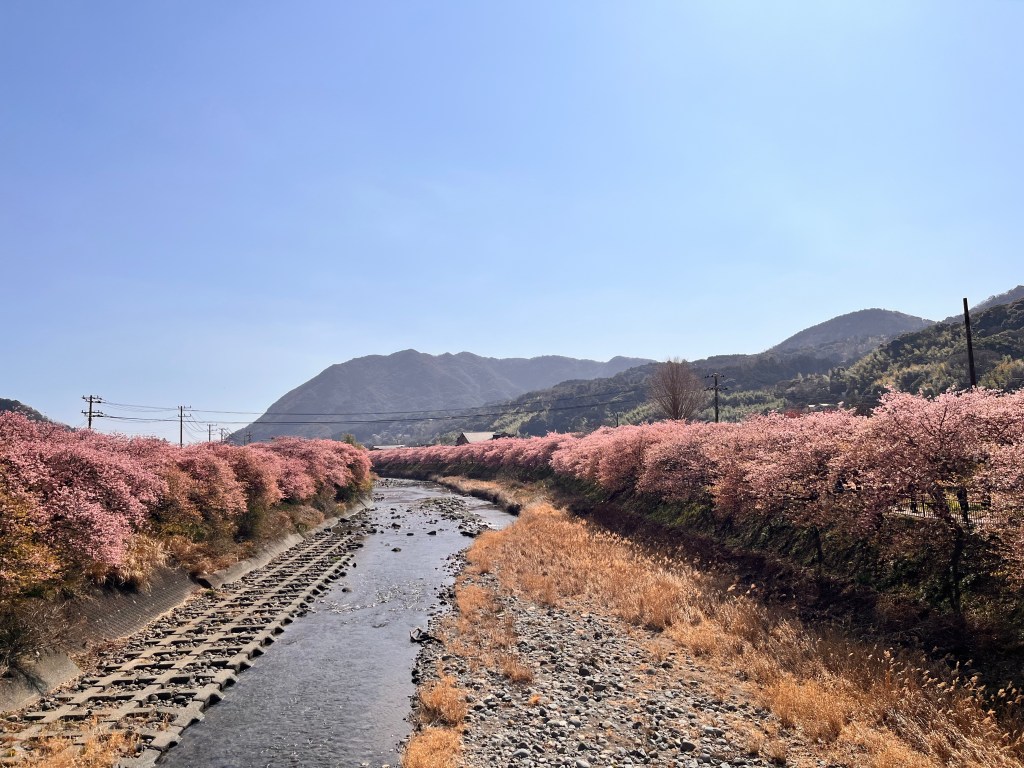
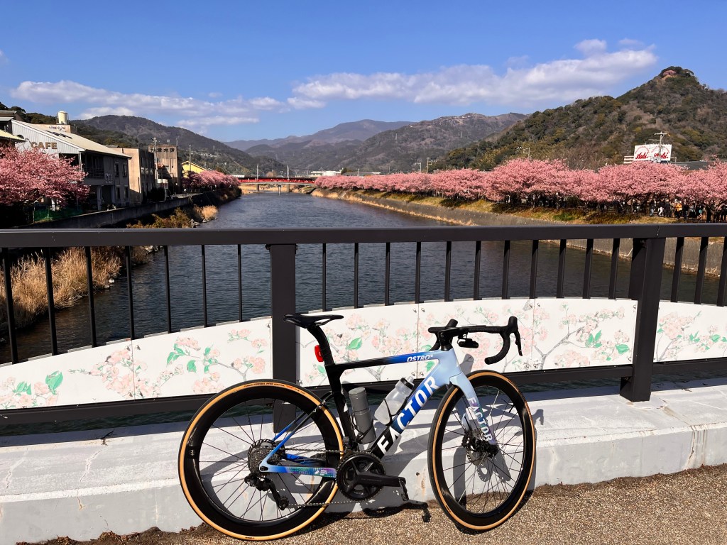
Since it takes only about a week from the start of blooming to full bloom, timing your visit can be difficult. Still, the uninterrupted row of cherry trees stretching several kilometers along the Kawazu River from its mouth is well worth seeing. Cherry trees are planted throughout the town, so it’s best to wander freely and follow your instincts. You may stumble upon unexpectedly magnificent blossoms tucked away in a quiet back alley.
You can reach Kawazu directly from the Ito area via the Izu Kyuko Line. However, if you are making the effort, it is highly recommended to head south along National Route 135, which runs along the eastern coast of Izu.
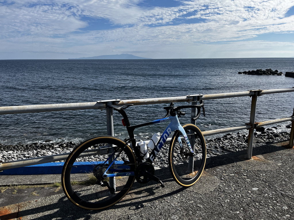
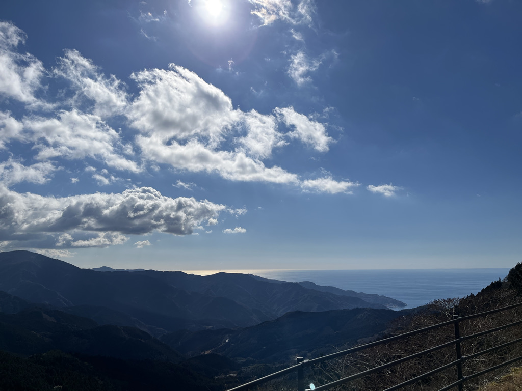
The distance from Odawara to Kawazu is 84 km. Though it follows the coastline, the route is a continuous series of ups and downs, with a total elevation gain of around 1,000 meters. It may not be an easy ride, but on a clear day you can see Izu Oshima floating in Sagami Bay, as well as the Izu Seven Islands further to the south. The views make the effort worthwhile.
Another option is a route that crosses Amagi Pass from Shuzenji:
This route heads south through the heart of the Izu Peninsula and becomes a hill climb over the Amagi Tunnel. The climb from the Shuzenji side is relatively gentle at first. There are two roads—Routes 414 and 349—which eventually merge at Yugashima, a hot spring area. Route 349, with lighter traffic, is recommended. If you wish to stop at the Tsukigase roadside station along the way, simply cross the Kano River to reach Route 414. At this roadside station, you can enjoy light meals such as the Shuzenji Burger (with fried amago trout) and soba noodles—making it a pleasant rest stop.
After passing Yugashima, the gradient begins to steepen, though it generally stays around 6% and does not become overwhelmingly severe. During the climb, you may want to stop at Joren Falls, a scenic waterfall. However, to see the falls up close, you must descend and climb a considerable number of stairs on foot, so proper walking shoes are essential.
Further up, you will find the Amagi-goe roadside . From there, it is less than 2 km to the peak at Amagi Tunnel. It may be a good place to take a break.
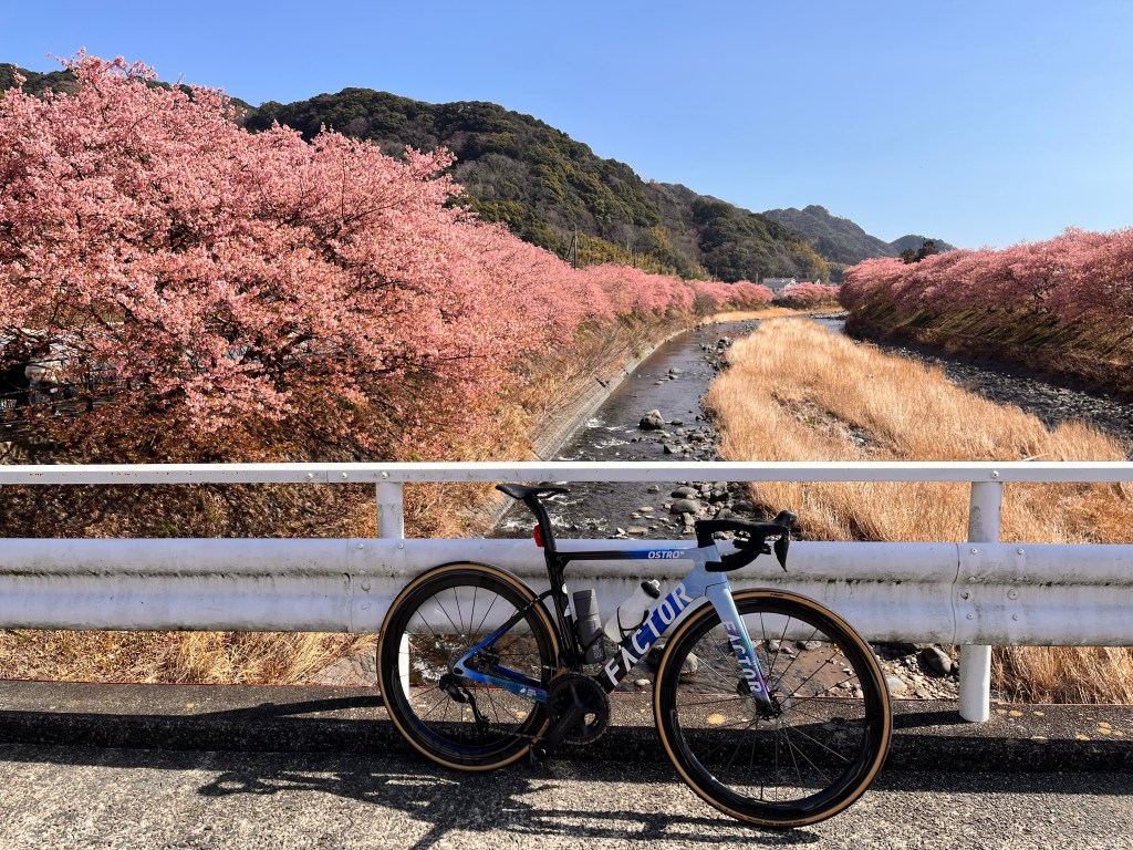
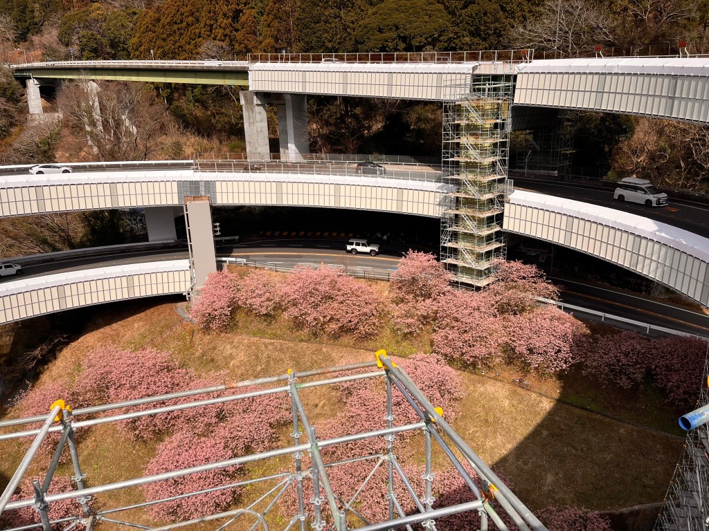
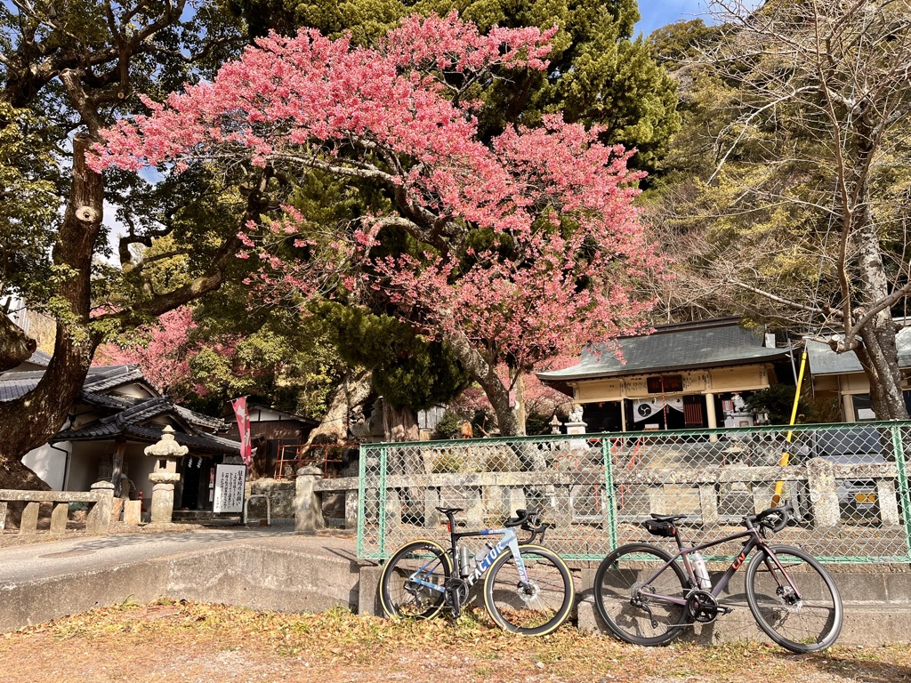
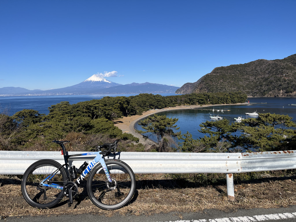
Once you pass through the Amagi Tunnel, it is downhill all the way to Kawazu. Be careful, as some sections have gradients of around 10%. As you descend through the mountains, a massive loop-shaped bridge will eventually come into view. Known as the Kawazu Nanadaru Loop Bridge, this double-loop structure eliminates a 45-meter elevation difference in one dramatic sweep—an experience rarely found elsewhere. Kawazu-zakura trees are planted along the inner slopes of the loop.
Near the loop bridge is an area that provides access to walking trails connecting the seven waterfalls known as Kawazu Nanadaru, and it is also a hot spring district. Izu is famous for its wasabi, and here you will find Wasabi-en Kadoya Shokudo, well known for its “wasabi-don” (rice topped generously with fresh wasabi). It is a popular restaurant, and you may have to wait up to an hour at times, but if you have the time, it is well worth trying—provided you don’t mind the sharp kick of fresh wasabi.
After passing the loop bridge, the gradient becomes gentler as you gradually approach the town of Kawazu. When you catch sight of the rows of cherry trees lining the Kawazu River, follow the riverside promenade and enjoy the blossoms at your leisure.
January is still winter. That holds true even in Izu, which is considered a relatively warm region. At times, temperatures drop into the single digits, and the mountains of the Amagi Highlands, rising over 1,000 meters above sea level, may be dusted with snow.
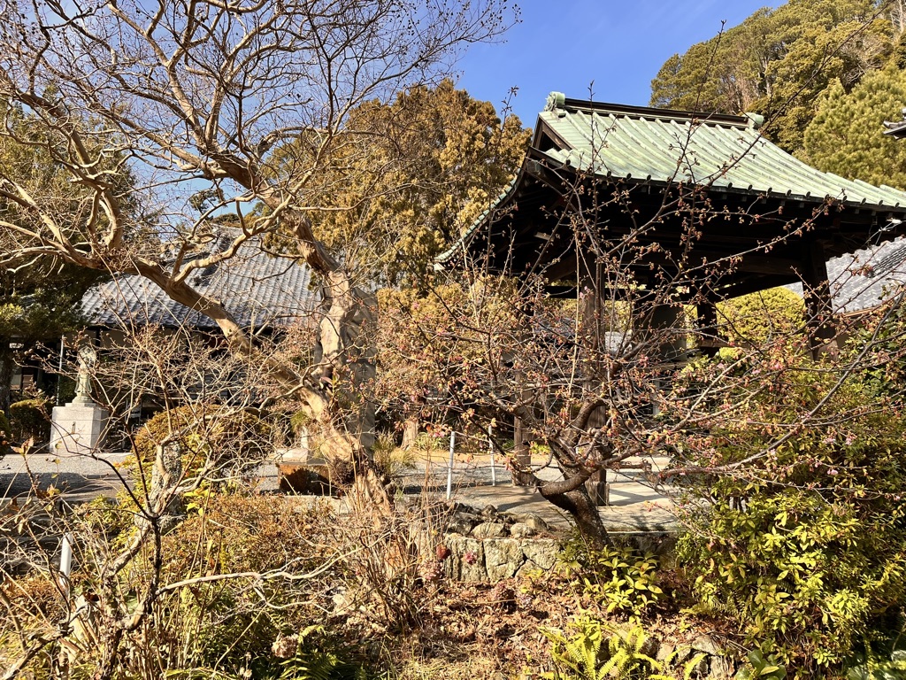
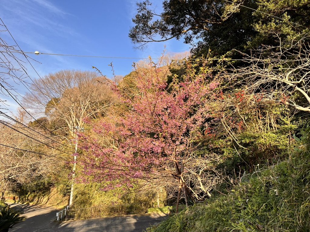
Even in such cold weather, however, there is a type of cherry blossom that heralds the arrival of spring a little early: the Toi-zakura. When people think of cherry blossoms, they usually picture the Somei Yoshino variety, which blooms from late March to early April.
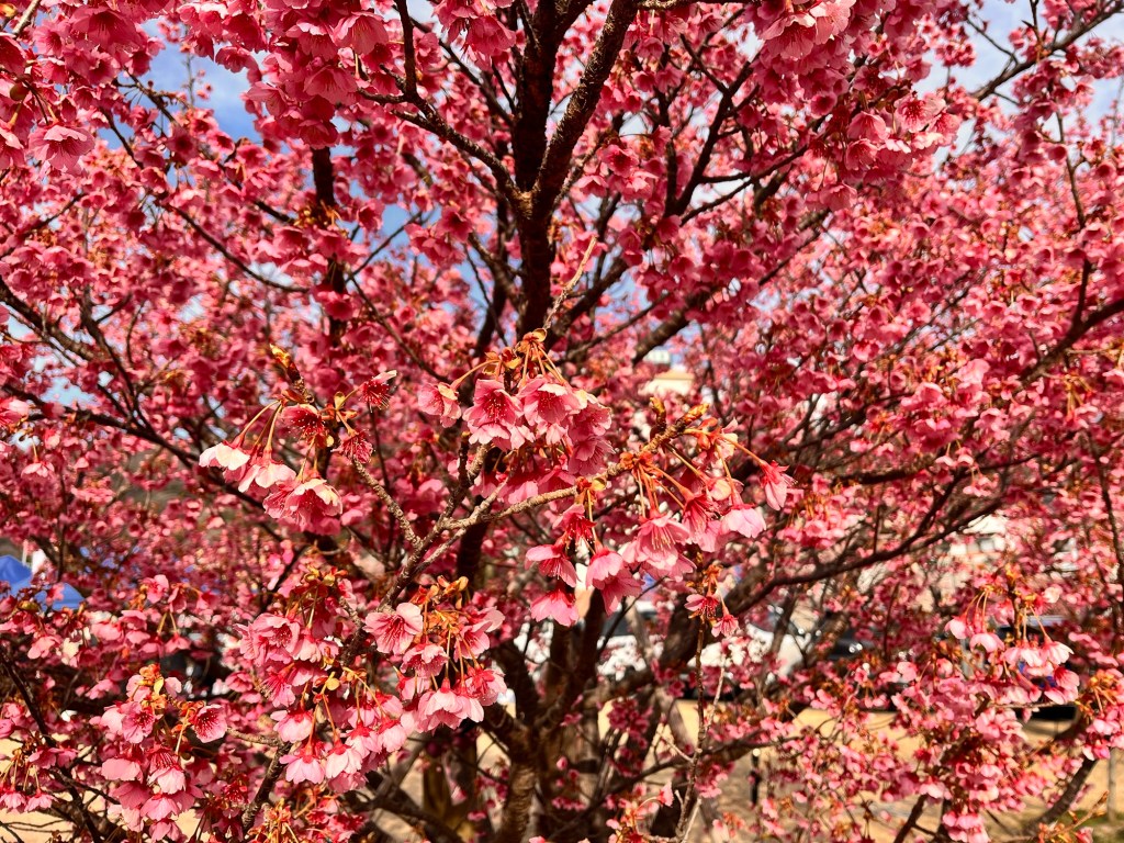
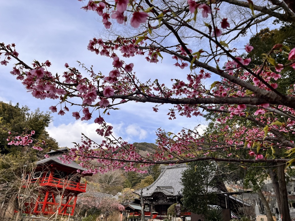
Yet there are some varieties that reach full bloom even earlier. Among these early bloomers, the Kawazu-zakura is the most famous. True to its name, it blooms in Kawazu on the eastern side of Izu, typically from mid-February to early March. The rows of cherry trees lining the Kawazu River near Kawazu Station are spectacular, and when they reach full bloom, crowds flock there day after day.
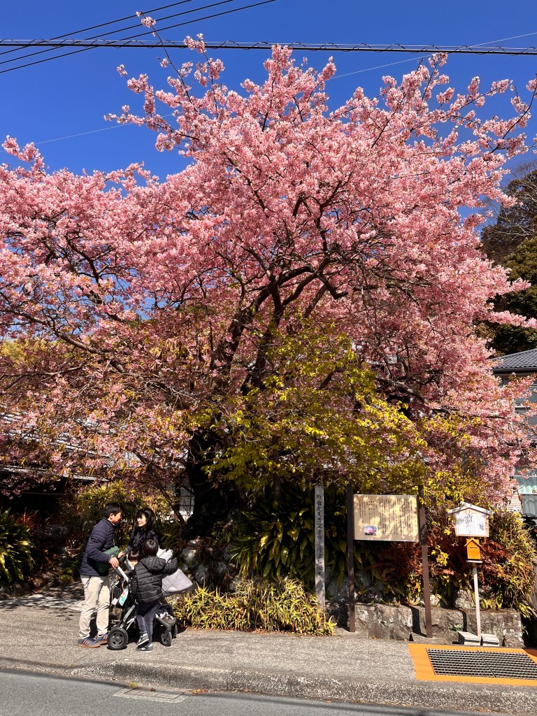
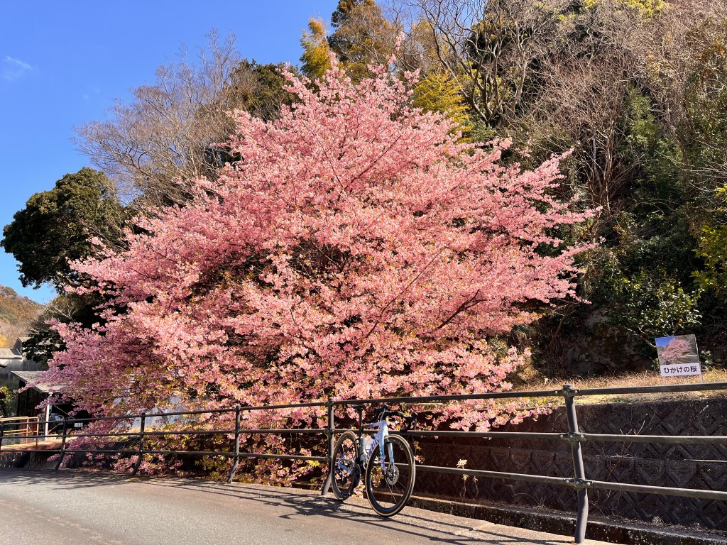
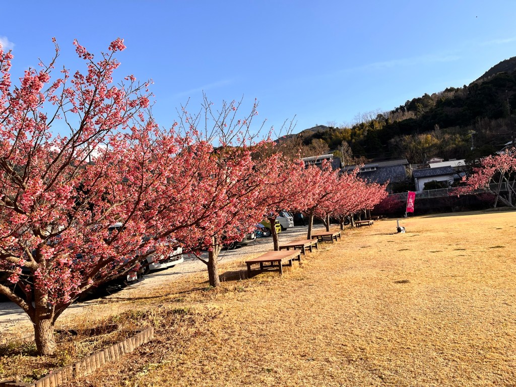
The Toi-zakura blooms about a month earlier than the Kawazu-zakura and is perhaps the earliest-blooming cherry blossom of all. While Kawazu-zakura is well known, it is hard to say the same for Toi-zakura. There are likely several reasons for this. One may be that there is no grand avenue of cherry trees; instead, a few trees stand within temple or shrine grounds, or are scattered here and there throughout the town. The largest cluster can be found at Matsubara Park along Toi Beach and in the surrounding area, but even there, the atmosphere feels modest.
Another reason may be that Toi itself is not particularly easy to access. By public transportation, one must first travel by train to Shuzenji, then take a bus that runs only about once an hour, and ride it for nearly another hour before finally arriving.
Moreover, the western side of the Izu Peninsula, where Toi is located, is especially subject to strong westerly winds in winter, with gusts of 7 to 9 meters per second being common. Walking around town to visit the scattered cherry trees in such conditions can be quite challenging.
All of these factors may contribute to why the Toi-zakura has not become widely known. Nevertheless, from late January to early February each year, the Toi Sakura Festival is held, offering seasonal events unique to this time of year.
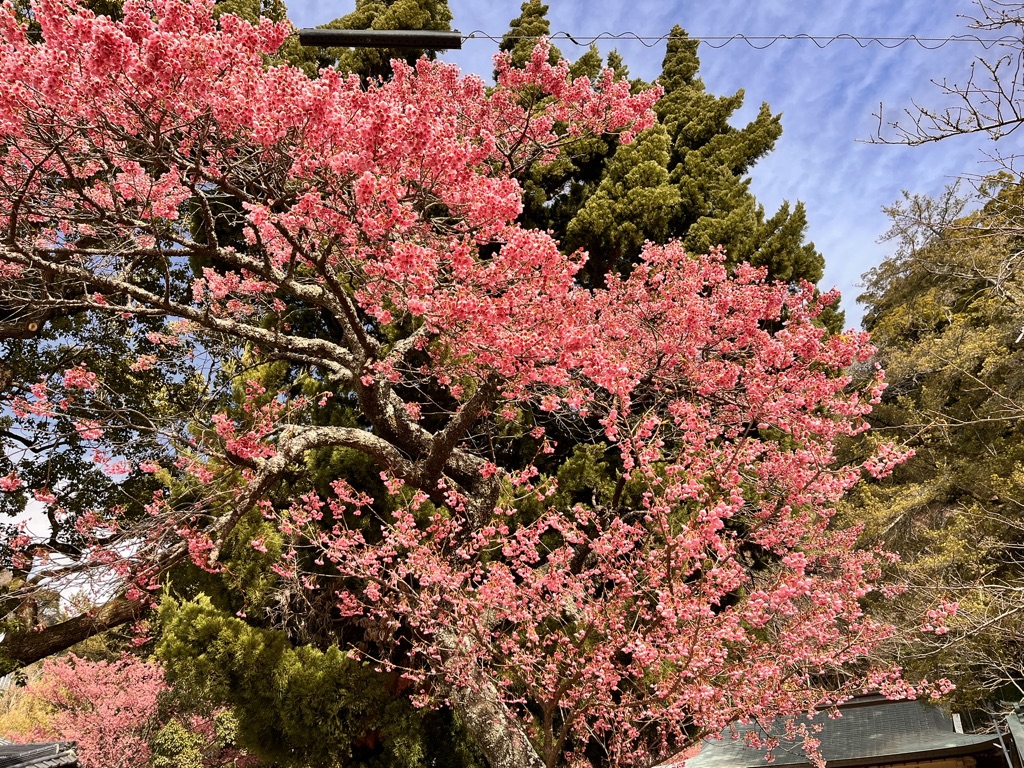
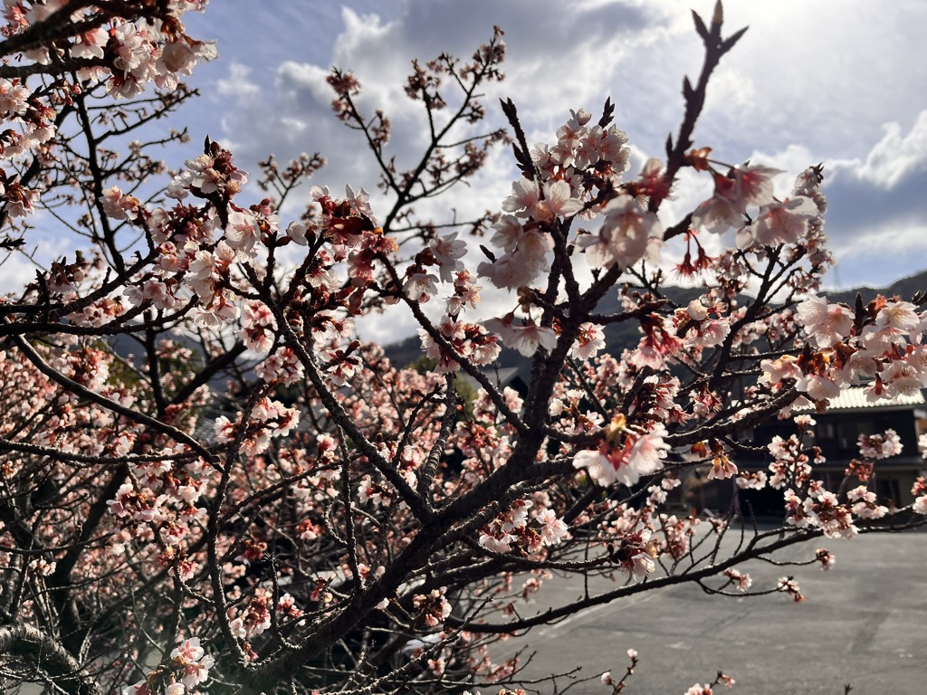
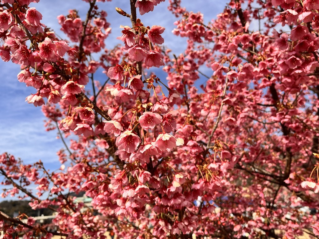
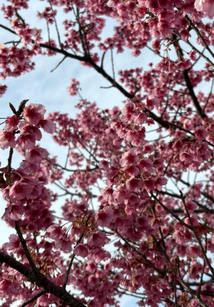
Compared to Somei Yoshino, Toi-zakura blossoms are a deeper pink, with longer stems, and they bloom in a slightly downward-hanging manner. The trees themselves are relatively slender and small, making it possible to step close to branches blooming at about eye level and admire the flowers in detail.
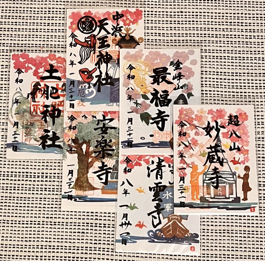
During the festival period, some temples and shrines offer limited-edition goshuin—special commemorative seals available only at that time. These temples and shrines are scattered throughout Toi and in nearby areas. Since Toi-zakura quietly bloom within their grounds, visiting them while collecting goshuin can be a pleasant way to explore. However, covering the distance on foot can be demanding. The terrain is not particularly steep, so a bicycle is an ideal means of getting around.
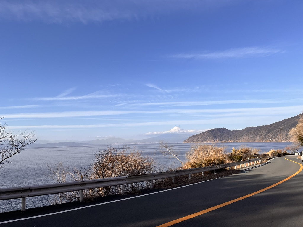
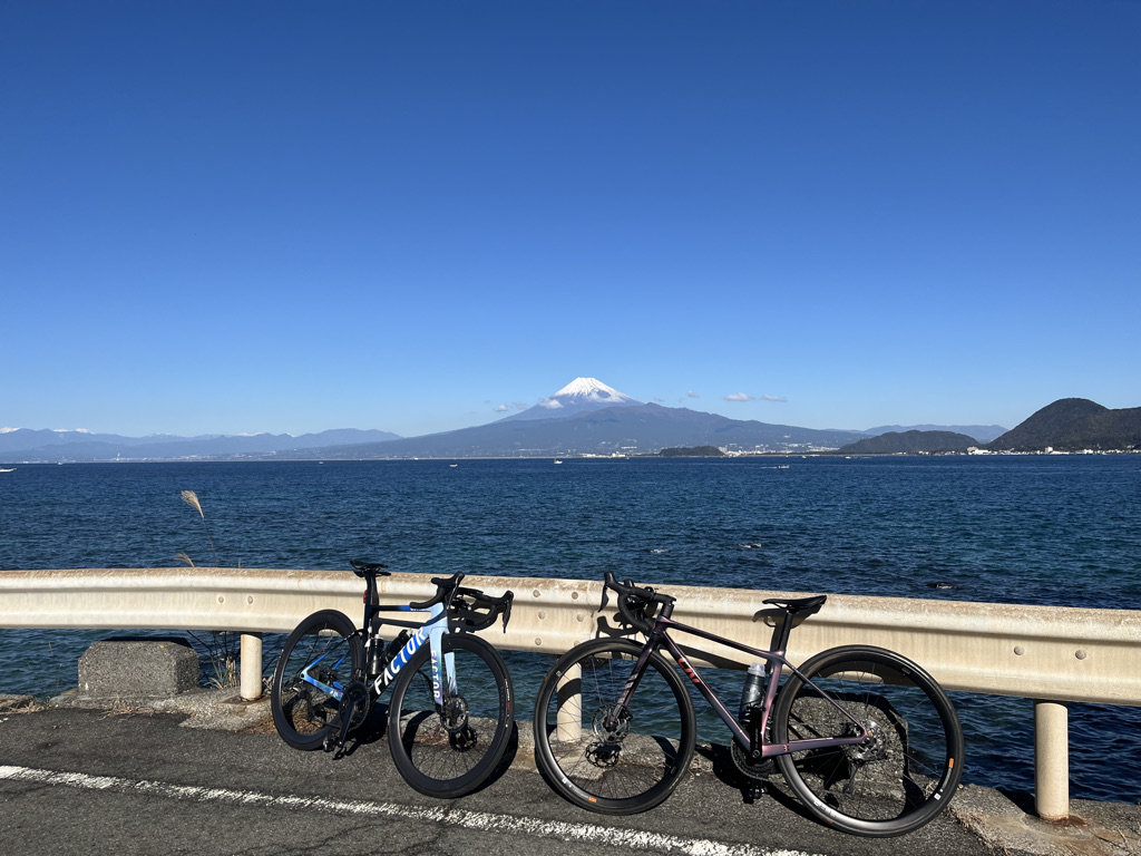
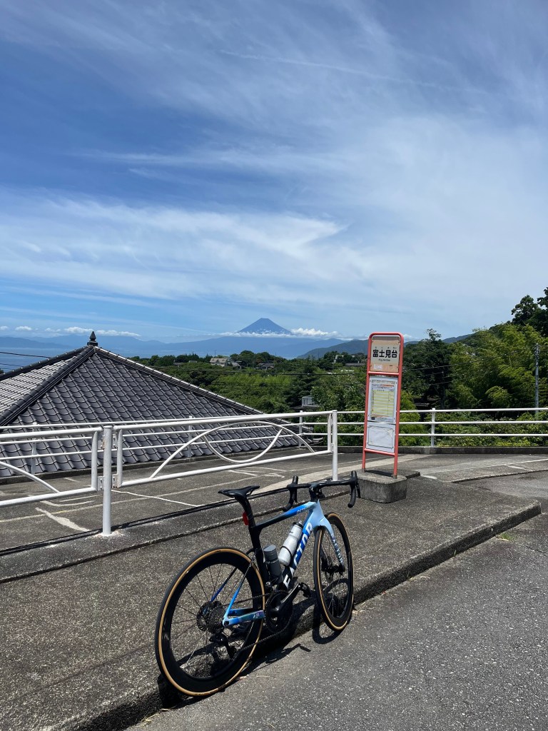
One of the pleasures of cycling in West Izu is riding along coastal roads with Mount Fuji visible in the distance. In particular, the route heading south from Toi toward Cape Lovers (Koibito Misaki) offers views of Mount Fuji from various points along the way.
In 2026, the blossoms bloomed about two weeks earlier than usual, with some trees reaching full bloom by mid-January. Due to successive cold waves, strong winds blew day after day. It was not until the end of January, when the wind miraculously weakened for just one day, that I was able to visit. Fortunately, many of the blossoms were still in full, vibrant bloom, and I was able to enjoy them at various locations.
There are several ways to reach Toi:
The coastal route from the Numazu area If starting from Numazu, this route is recommended. Along Route 17, you can ride a mostly flat stretch with minimal elevation change along a bay known as Nishiura, heading toward the distinctive cape called Osezaki. Across the bay, Mount Fuji comes into view.
However, beyond Osezaki, the coastal road features a series of ups and downs. At times, it feels as though you are riding through the mountains. Still, there are many scenic viewpoints along the way, such as Kirameki no Oka, Deai Misaki overlooking the town of Heda, and Ao no Oka with views toward southern Izu.
The climbing route from Shuzenji via the Nishi-Izu Skyline From Shuzenji to the entrance of the Nishi-Izu Skyline, there is an elevation gain of about 700 meters. The first few kilometers are quite steep, but after that the climb becomes more gradual. Although Mount Fuji occasionally comes into view, much of the route runs through forested areas. Just before reaching the Skyline, there is a facility called Daruma-yama Rest House, which has an observation deck overlooking Mount Fuji and offers light snacks—an ideal place for a break.
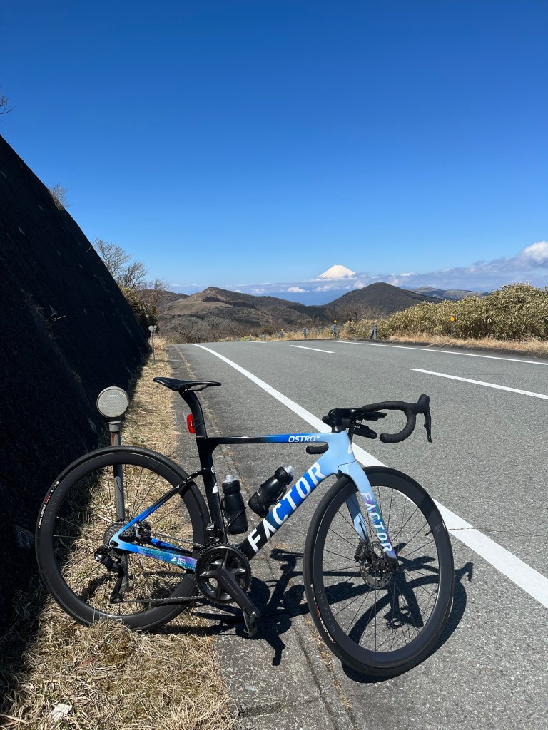
Even after entering the Nishi-Izu Skyline, the road continues through trees for a while, but gradually the view opens up, revealing distant vistas of Hakone and eastern Izu. Ahead, you will notice a bowl-shaped mountain: Mount Daruma. The Skyline climbs along its mid-slope with a gradient of about 9 percent. During this climb, be sure to look back. On a clear day, Mount Fuji will come into view—one of the finest vistas along the Nishi-Izu Skyline.
Looking back again while climbing Kokiyama, you can see Mount Fuji beyond Mount Daruma. From there, the road becomes a downhill stretch all the way to Toi, and Mount Fuji disappears behind the mountains, making this the last spot along the way where you can see it.
At Toi Pass, leave the Skyline and continue downhill toward Toi. You will arrive in less than 30 minutes.
Follow Route 349 or 414 along the Kano River toward Tsukigase. From Tsukigase, take Route 136 and continue on a gradual climb. Although this route offers no scenic views, there are no steep slopes, so even those who are not confident in their legs can reach Toi at a relaxed pace. Along the way, you will pass through the Funabara Tunnel, which is over one kilometer long, so be sure to turn on both your front and rear lights. Once through the tunnel, you can enjoy a wonderful downhill ride all the way to Toi.
“Izu-Ichi” refers to a cycling route that makes a complete loop around the Izu Peninsula along the coast. There are several variations, each differing in total distance and elevation gain.
Much of the Izu Peninsula consists of sheer cliffs that drop straight down to the sea, so even though the route follows the coastline, it is rarely flat. Even the shorter routes exceed 200 km with more than 3,000 m of elevation gain.
The route I rode was the most demanding of all the variations: a total distance of 270 km with 4,300 m of elevation gain. Starting in Odawara, it circles the peninsula clockwise, crosses the Hakone Pass at an elevation of 846 m, and returns to Odawara.
Soon after starting in Odawara, the route joins Route 135 along the coast. Repeating short climbs and descents, it heads steadily south. If you depart late at night, you will likely see the sun rise somewhere along the eastern coast of the Izu Peninsula.
After 100 km from Odawara, you reach the town of Shimoda. From there, there are two options: continue farther south toward Cape Irozaki at the southernmost tip of the peninsula, or take a shortcut across to the west coast. Naturally, the recommended choice is the route to Cape Irozaki.
Cape Irozaki is one of the few places in Minami-Izu with shops and vending machines, making it an ideal spot for rest and resupply. Reaching the Irozaki Lighthouse requires a short walk of a few minutes, but the view from there is magnificent, so it is well worth visiting if time allows. Be aware, however, that the area around Cape Irozaki is not accessible 24 hours a day, so be sure to check opening hours in advance.
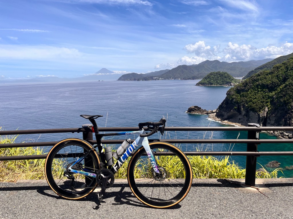
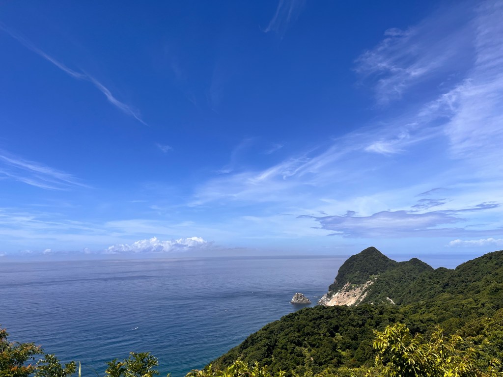
Leaving Cape Irozaki and heading toward West Izu, there are spots where you can look out over sheer cliffs and emerald-blue, crystal-clear seas. Enjoy these views as you ride on.
After that, the route briefly leaves the coast, passing through a series of tunnels and a short climbing section. Following a descent, the road gently climbs through open rice fields before passing another tunnel—this marks the beginning of the West Izu section. At this point, you have covered about 130 km from Odawara, roughly half the total distance, but the accumulated elevation gain is still only around 1,800 m, not yet half of the total.
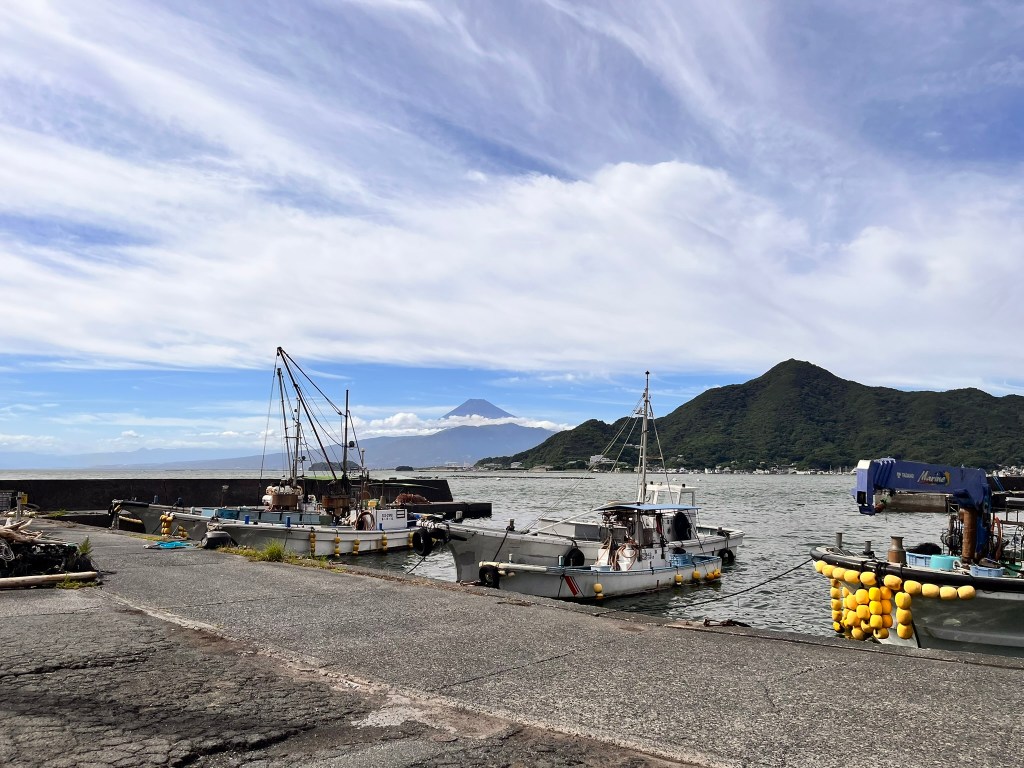
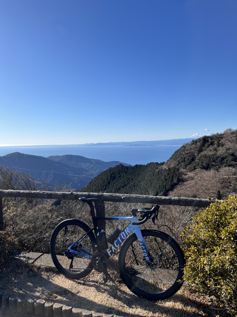
After the tunnel, a winding downhill brings the sea back into view. Passing quiet fishing villages, the climbing begins again. For a while, the route is a continuous series of ups and downs, with gradients reaching around 10% as you climb to elevations of several hundred meters. The sea disappears once more as the road winds through the mountains with repeated climbs and descents. Eventually, you reach a summit area with a few buildings—some may be cafés. From the parking area across the road, you can look out over the sea of West Izu: Suruga Bay.
After that come more descents, gentle climbs, and then a longer downhill. Soon you will see a sign indicating entry into Matsuzaki Town. Farther on, the road splits to the right, but you can continue straight on the main route. If you do turn right and climb a short distance, however, you will reach an observation point overlooking the Ishibu Rice Terraces, a distinctive landscape of small, table-like rice paddies layered across a steep slope.
The downhill eventually leads to the area of Kumomi, a quiet fishing port surrounded by cliffs. On a clear day, Mount Fuji can be seen from here. The stretch from Kumomi to Matsuzaki is, in my opinion, the most beautiful section of the Izu Peninsula. The road is carved into seaside cliffs, twisting along the rock face with repeated climbs and descents.
Eventually, the townscape of Matsuzaki comes into view, followed by a downhill ride into town.
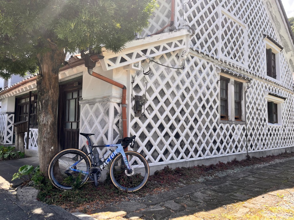
Matsuzaki is a beautiful town. Many old houses remain, featuring “namako walls”—grid-patterned plaster walls—creating a calm, rural atmosphere entirely different from that of a big city. Time seems to flow gently here, and it is easy to linger longer than planned. If you have time, take a walk around town. Depending on the season, you may see flower fields planted in rice paddies before planting season, or, in spring, cherry blossom trees lining the river for several kilometers. This is why Matsuzaki is known as the “Town of Flowers and Romance.”
Leaving Matsuzaki, the route heads north and soon reaches Dogashima, an area full of attractions and also popular for its hot spring inns.
Beyond Dogashima, the road passes through a series of tunnels, with little view of the sea, making this a somewhat monotonous section. Given the mountainous nature of the Izu Peninsula, this is unavoidable—there is no other route that stays closer to the coastline throughout.
Eventually, you will see signs for a scenic spot called Koganezaki, marking the town of Ugusu. Ugusu is very small and passes by quickly, but nearby Koganezaki offers a rare view: steep cliff faces that glow golden in the setting sun. Even outside sunset hours, the yellowish rock can appear golden depending on the light. Ugusu is also the starting point for the climbing route up Nishina Pass.
The stretch from Ugusu to Toi is one of the gentler sections in West Izu, with relatively relaxed ups and downs. The peak of this section is a viewpoint known as Lover’s Cape, after which the road gradually descends. On a clear day, you can ride with Mount Fuji in view ahead.
Soon you arrive in Toi, a town famous for the Toi Gold Mine and its many hot spring inns—perhaps the most prominent tourist destination in West Izu. After passing through Toi, the route leaves the coast slightly and a climbing section begins, with two ascents of several hundred meters each. There is an observation deck along the way. The road narrows, houses become scarce, and after a series of hairpin turns on the descent, you may spot a uniquely shaped cape below—that is the town of Heda.
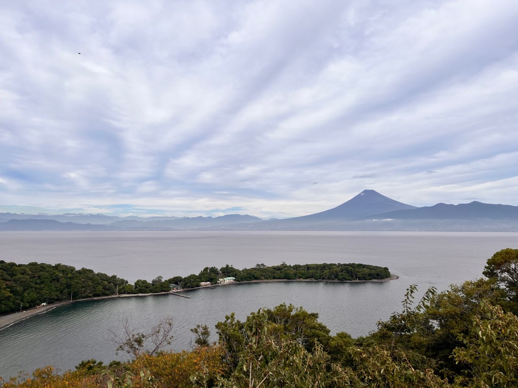
Heda is a quiet town nestled between mountains and protected by a sandbar, and it marks the starting point of the steep Heda Pass. However, since Izu-Ichi follows the coast, it does not head toward Heda Pass. Leaving Heda toward Cape Osezaki, the road quickly steepens to around a 10% gradient, climbing more than 100 meters in one go. There is an observation point just before the peak where you can look down over Heda—an ideal place for a short break. After another climb of similar intensity and a tunnel, the harsh ups and downs of the Izu Peninsula finally come to an end. A downhill follows, and soon you will see a cape reminiscent of Heda—this is Osezaki. Across the sea, Mount Fuji may also come into view.
From there, ride on with Mount Fuji and the sea to your left, descending to a road close to sea level. For a while, there are no significant climbs.
As the coastal road turns toward central Numazu, you bid farewell to the sea. Suddenly, you are thrown into urban traffic, stopping at signals and watching for an unbroken flow of cars as you head toward Hakone Pass—the final peak and the last major challenge of Izu-Ichi. This is the first sustained climb to around 800 m elevation on the route. Looking at the elevation profile on Strava, Hakone Pass clearly stands out. Still, do not forget that by this point you have already accumulated around 3,500 m of climbing—the Izu Peninsula is demanding even along its coast.
You will climb National Route 1 steadily. The gradient averages around 6%, so it is not excessively steep, but the climb is over 10 km long and may feel punishing to an already exhausted body and mind. Along the way, there is a signal where the road branches toward the Nakayama Castle Ruins. Cyclists are recommended to take this route, as there are vending machines at the ruins where you can rest and resupply.
After passing the ruins, you soon rejoin Route 1. There are no traffic lights here, so be sure to check carefully for cars before merging into the uphill lane. Though it may feel as if the climb will never end, the mountain ridge will gradually draw closer. When you see buildings and parking areas that look like facilities of some sort, the signal at Hakone Pass is just ahead—the end of this grueling journey is near.
From Hakone Pass, descend toward Lake Ashinoko. Continue on, then climb briefly again from the town of Motohakone—this lasts only a few minutes. At the next signal, you must choose to turn left or right. Turning right leads to a steep downhill on a lightly trafficked road, while turning left means climbing a bit more before descending on a route with gentler gradients but heavier traffic and possible congestion.
Either way, once you begin descending, it is almost all downhill to Odawara. Prioritize safety and take it easy, especially through hot spring areas where there may be many pedestrians depending on the time of day.
When the winding road finally straightens, that is your victory run into Odawara. Savor the final pedal strokes as you feel the long adventure coming to an end.
Heda is a small fishing port, flanked by steep mountains on both sides, with a long, narrow sandspit lined with pine trees stretching out into the sea.
From there, a road climbs steeply up to the starting point of the Nishi-Izu Skyline, a route that runs north to south at around 800 meters above sea level.
Starting from Heda Port, the road reaches Heda Pass at about 700 meters in elevation after roughly 10 kilometers. This gives an average gradient of 7%. But an average is only an average—the nature of the climb changes dramatically between the first and second halves. In that sense, it is similar in structure to the climb to Nishina Pass. Compared by distance, Heda Pass is more compact, but in terms of severity it is no less unforgiving. After a gentle 200-meter gain over the first 4.6 kilometers, the road climbs another 540 meters in the remaining 5.4 kilometers. That means an average gradient of 10% in the second half. In reality, it holds closer to a relentless 12%, with only occasional stretches that ease off to 7–8%, but it never gets any gentler than that.
Less than a kilometer from the start in Heda town, you’ll reach Michi-no-Eki Kurura. In addition to selling local products, it offers a footbath and even a public hot spring, making it a great place to stop and relax if time allows. https://kururaheda.net/
Beyond Kurura, houses grow sparse, the mountains close in, and the road narrows into a valley. Following the Ōkawa River on the left, the road curves sharply across the stream and the gradient begins to bite. After a few bends, the slope steepens further, demanding more strength from your legs—this is where Heda Pass truly begins. The 10% ramps continue without respite, and when you glance upward, you can see the road snaking toward the high ridges above you.
Keep grinding and you’ll eventually reach a fork where you must continue straight. The slope remains merciless, often hitting 12%, and never offering the kindness of a 5% grade.
Yet as the altitude increases, the views begin to open up. You’ll see the ridgelines of the Nishi-Izu mountains, or the valley you’ve just climbed out of spread below. The road clings to the steep slopes, winding back and forth as it gains elevation. When Suruga Bay, hidden until now by the mountains, finally comes into view, you’ll know the pass is only about a kilometer away. The sky feels closer, and to the right you can see the faraway ridges of western Izu as you battle the last brutal ramps. The pass itself is a cut in the ridge, but a large parking area just before it can serve as a finishing point—it’s as good as summiting. From there, the town of Heda is hidden by the mountains in front, but you can look out over Suruga Bay and across the Shizuoka plain beyond.
After catching your breath, you may descend toward Shuzenji.
Or continue climbing onto the Nishi-Izu Skyline, where even higher elevations and magnificent views await.
The joy beyond the pain is a supreme reward granted only to those who conquer the climb.
The route with the most merciless slope in the Izu Peninsula is from this Ugusu.
From Ugusu, a small town by the sea, you start running towards the Amagi Plateau in front of you, and it is a gentle riverside road for a while.
Eventually, when the houses were cut off and you entered the mountainous area surrounded by trees, the road became as narrow as a car, and the slope was around 10%.
This is where this route is in production. A merciless slope with an average slope of 9% that climbs about 840m in about 9 km is waiting.
There are two flat sections of about a few hundred meters in the middle, so you can take a break there, but there are places where it is instantaneous to 30% in the inside of the slope or curve of about 15%.
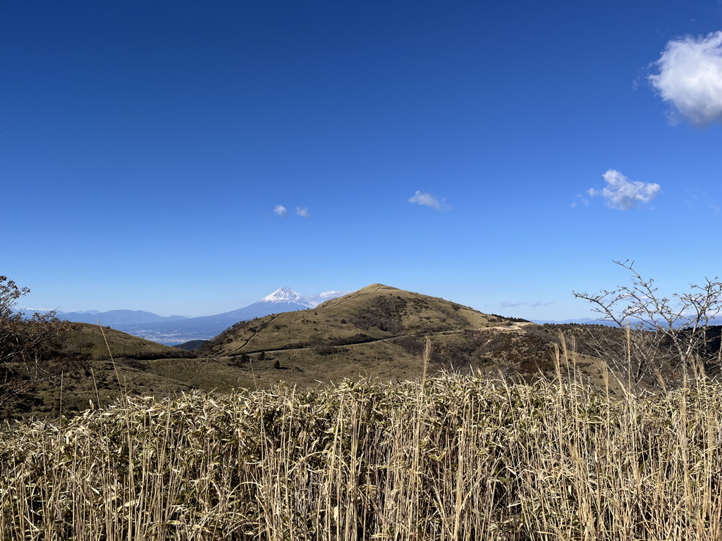
If the altitude rises and you start to see the town and sea of Ugusu, the starting point from the mountainous area, you will be a little closer to the Amagi Kogen Ranch.
There is a rest house on the ranch where you can enjoy snacks, so you can stop by.
Sometimes cows are released on the ranch depending on the season.
The road extends to the left at the end of the straight climb that runs through such a ranch. If you turn around, you will see the scenery full of openness overlooking Suruga Bay.
It’s a little bit to the pass. The slope of nearly 10% continues until the end, but in the majestic scenery without trees blocking it, when you climb the ridge road, you feel that your legs, which should have been tired, will return to your strength.
The sign of Nishina Pass is the goal. There is a stone monument on the side of the road. The ranch is close, so there is also a sign that says “Beware of cows”.
From the pass, you can see Suruga Bay, and on a sunny day, you can see Mt. Fuji in the distance.
If you get off your bike and climb the hiking trail a little, you can go to the top of the mountain.